 This site's pick
Guides
Language
EnglishCurrency
US dollar · $Prices on GetYourGuide appear in your chosen currency.
Guide · The island
Symi, Greece: a small island with a grand harbor
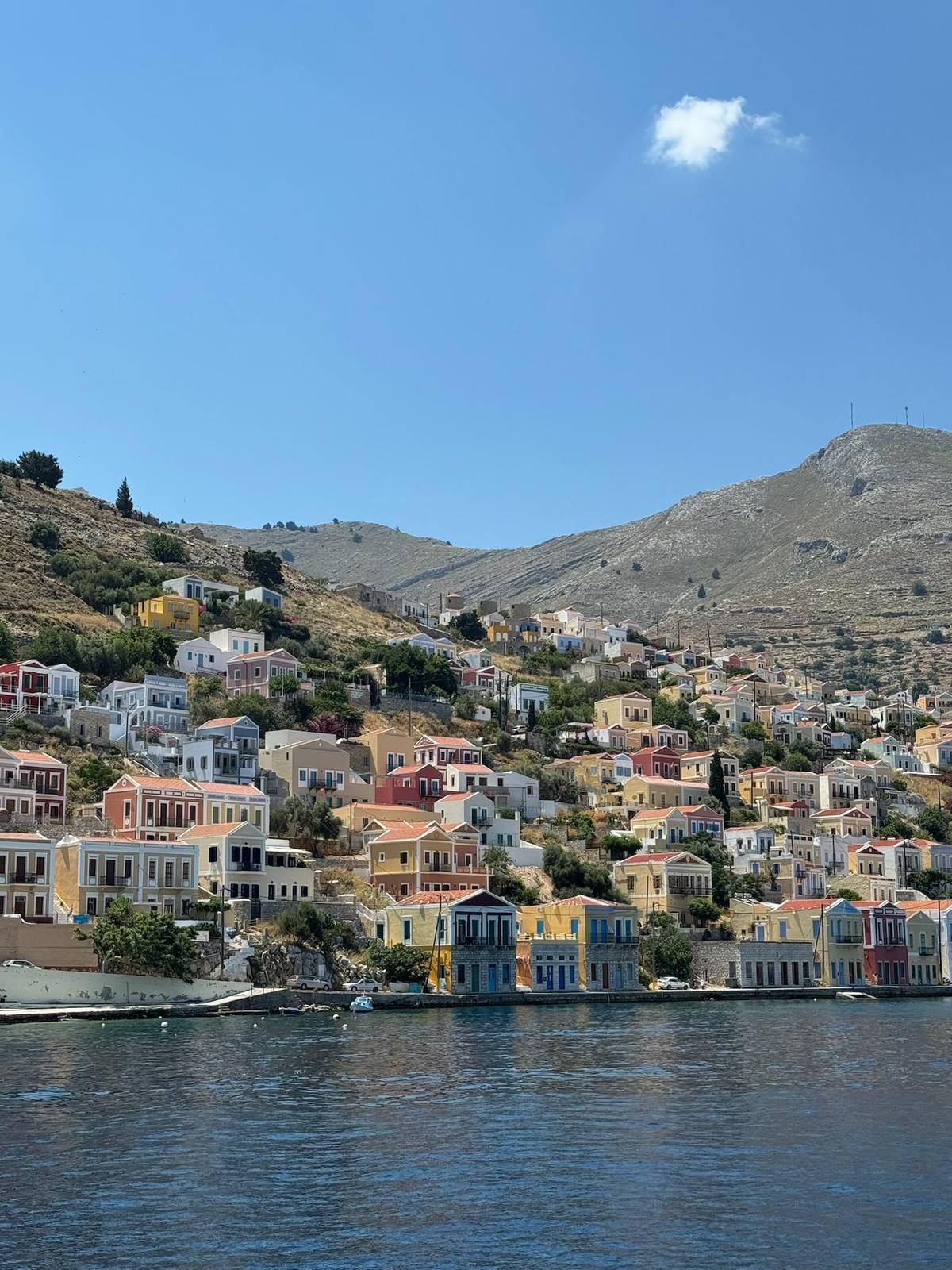
Symi, Greece is a short sea crossing from Rhodes, and most visitors meet it the same way: a boat turns into a bay lined with tall painted houses. Here is the island in one page, so you know what you are looking at.
Check availabilityfrom $69 · free to cancel
Editorial team, symiboattrip.comUpdated October 18, 2026Reading time 6 min32 sources
The island at a glance
- 01Where
- A small island near Rhodes and the Turkish coast, in the Dodecanese.1
- 02The town
- Chora joins the harbor of Gialos to the old village of Chorio above it.2
- 03The climb
- The Kali Strata links harbor and village with 500 stone steps.3
- 05By boat
- This site's day trip gives you 3 hours on Symi plus a swim stop, from $69.
Where the island lies and how it looks on arrival
If you have ever asked where is Symi island, the short answer is: just off Rhodes, close to the Turkish coast. The Greek National Tourism Organisation calls it a small island near Rhodes and the Turkish coast and one of the most picturesque in the Dodecanese.1 On a map it looks like a scrap of rock beside its big neighbor, and the sea between them is where every visit begins.
Most people see it first from the deck. Visit Greece describes the town of Symi as one of the most beautiful and largest neoclassical settlements in Greece, with colorful houses rising in tiers up the slopes.6 That is no exaggeration on a clear morning: the facades climb from the water in ochre, pink and pale blue, with church domes and bell towers between them.
Behind the town the land rises fast. The island's highest mountain reaches 560 meters, and on its far side lies a forest of pine and native cypress.7 Day visitors rarely see that side, because the boats and the shops are on the harbor, but it explains why the island feels larger once you are on it than it looks from the sea.
The story in steps
From pirate-proof village to protected town
-
Before the harbor
Chorio on the hill
The oldest settlement gathered around the castle on the heights.3
-
14th century
The castle
The Knights of Saint John built it on the ruins of a Byzantine castle.8
-
1783
Panormitis rebuilt
Neophytos and Kallistos raised the church that pirate raids had destroyed.9
-
1863
The diving suit
Fotis Mastoridis brought it to the island; his wife tested it in the harbor.10
-
1881
The clock tower
The stone municipal clock on the waterfront dates from this year.11
-
1971
Protected
A ministerial decision named the town a historic site in need of protection.12
Gialos, Chorio and the Kali Strata
The ferry company Dodekanisos Seaways lists five settlements on the island: Chora, which takes in the harbor of Gialos and the village of Chorio, then Emporios, Marathounta, Pedi and Panormitis.2 When people say the colorful harbor of Symi, Greece, they mean Gialos, the waterfront where your boat ties up and where most of a short visit happens.
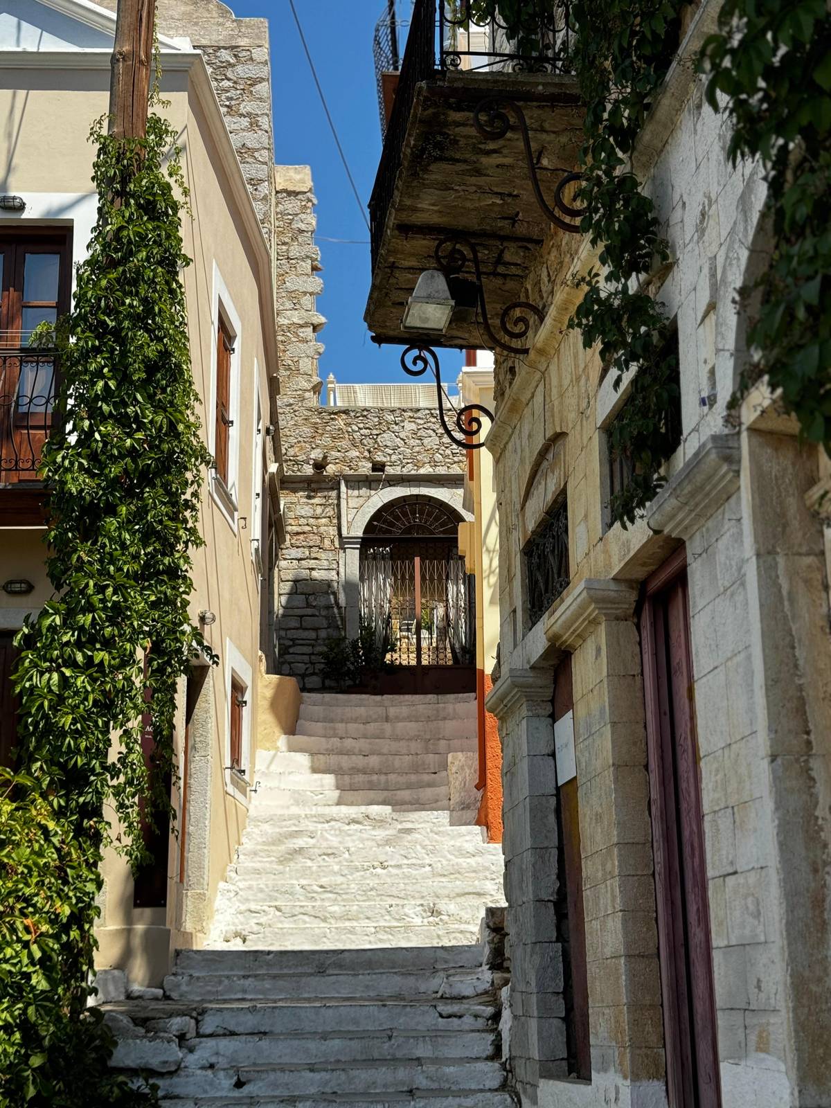
Gialos grew from the village above it. The Municipality of Symi tells how Chorio, the older settlement, spread down to the sea once the fear of pirates had passed, and how the captains and merchants of the island built their houses at the water.13 Chorio stays gathered around the castle on the hill, and both halves are joined by the Kali Strata, a road of 500 stone steps that was once the island's trade route.3
The whole of Chora is protected. It has been declared a traditional protected settlement, known for its colors, its ornate pediments and its courtyards paved with pebbles.14 The protection dates back to 1971, when a ministerial decision named the town a historic site in need of special protection.12 That is why the skyline still looks like an old print: new building has to fit the old pattern.
The settlements
Five places to know by name
| Place | What it is | On a day trip |
|---|---|---|
| Gialos | The harbor and waterfront | Where the boat docks |
| Chorio | The old village around the castle | 500 steps up the Kali Strata |
| Pedi | Seaside village with beaches | Too far for a short visit |
| Emporios | The second harbor, with a beach | Not on the boat route |
| Panormitis | The monastery in the south-west | Only on monastery trips |
Settlements as Dodekanisos Seaways and the Municipality of Symi list them.2315165
Three ways to see it
Fast boat, ferry ticket or the monastery day
This site's pick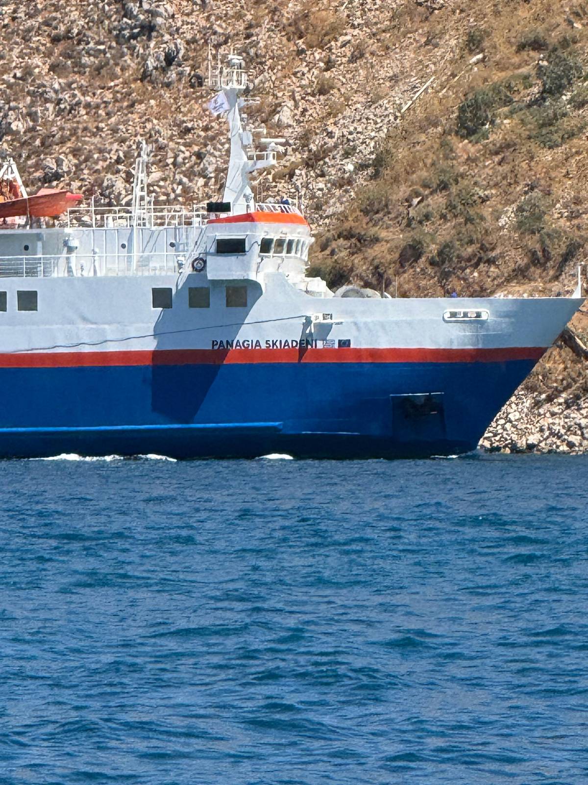 Stay longer
Ferry ticket
Dodekanisos Seaways
- Crossing
- 75 to 85 minutes
- Refunds
- Non-refundable
- Price
- from $24
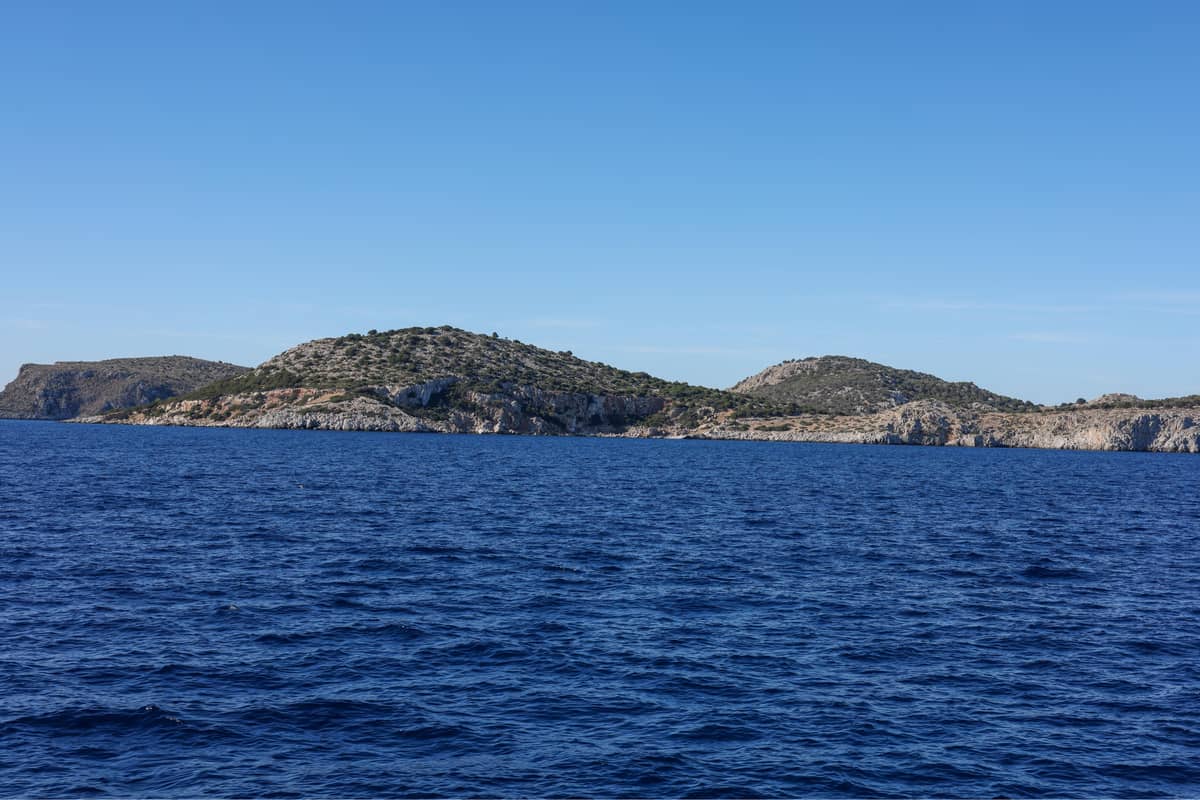 With Panormitis
Decision helper
A day trip or a longer stay?
Pick what matters most on your visit
Symi is a small island located near Rhodes and the Turkish coast. A mere speck on the map, it stands out as one of the most picturesque islands in the Dodecanese
Sponges, ships and the houses they paid for
The grand houses have a source. Visit Greece links the island's past to sponge diving, shipbuilding and wood carving.6 The municipality goes further and says that Symi once had the largest sponge-fishing fleet in the whole world.19 The money from that trade built the neoclassical mansions you see along the waterfront today.
Symi also had a hand in how sponges were fished. In 1863 a local man, Fotis Mastoridis, brought the diving suit to the island, and his wife Evgenia put it on and dived in the harbor to prove it was safe.10 The trade declined after the Italian governors of the Dodecanese banned sponge fishing during the First World War, and the population of the island fell year by year.20
You can still follow that story on foot. The map of Symi, Greece further down this page marks the harbor, the steps and the old village; small shops on the quay sell sponges, and the Archaeological and Folklore Museum, founded in 1961 in a mansion in the Lieni quarter of Chorio, holds pieces from the island's longer history.21
Map
From the harbors of Rhodes to the bays of Symi
The crossing from Rhodes, the island with its beaches and the monastery in the south, then a close look at the harbor and the steps up to Chorio.
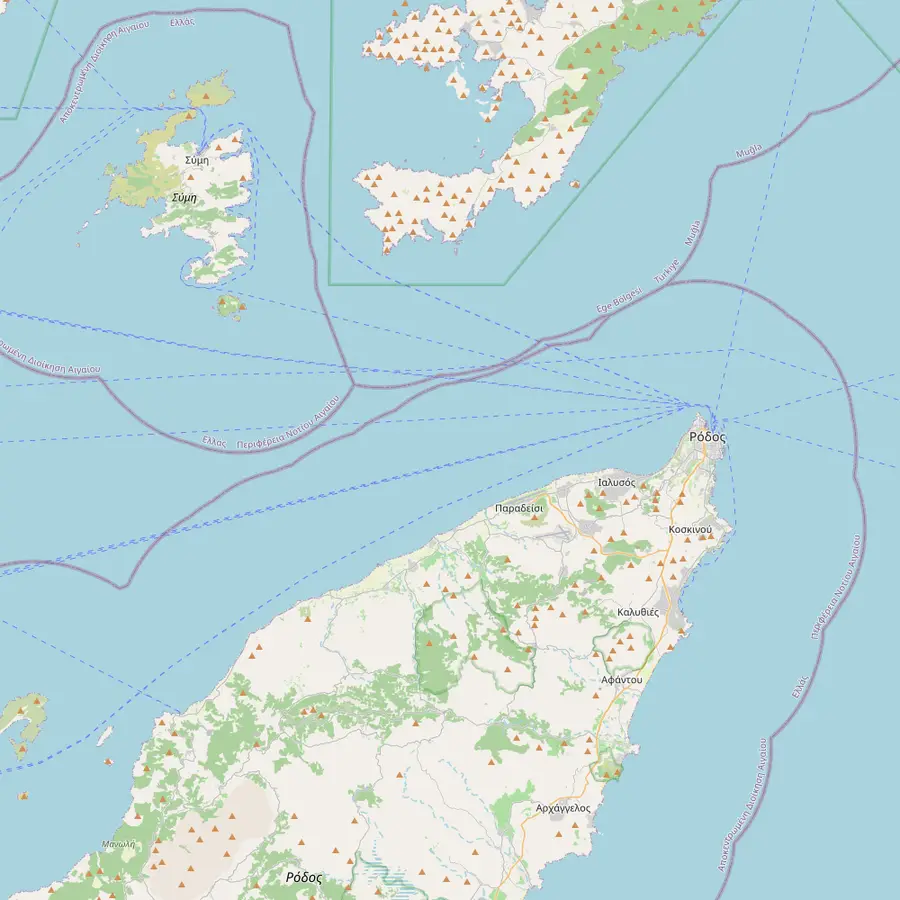 1Rhodes town2Faliraki3Kolymbia4Gialos
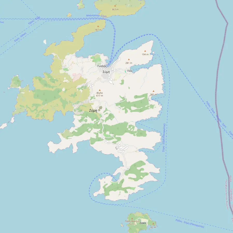 4Gialos7Emporios8Pedi9Agios Nikolaos10Agia Marina11St George's Bay12Nanou13Marathounda14Panormitis
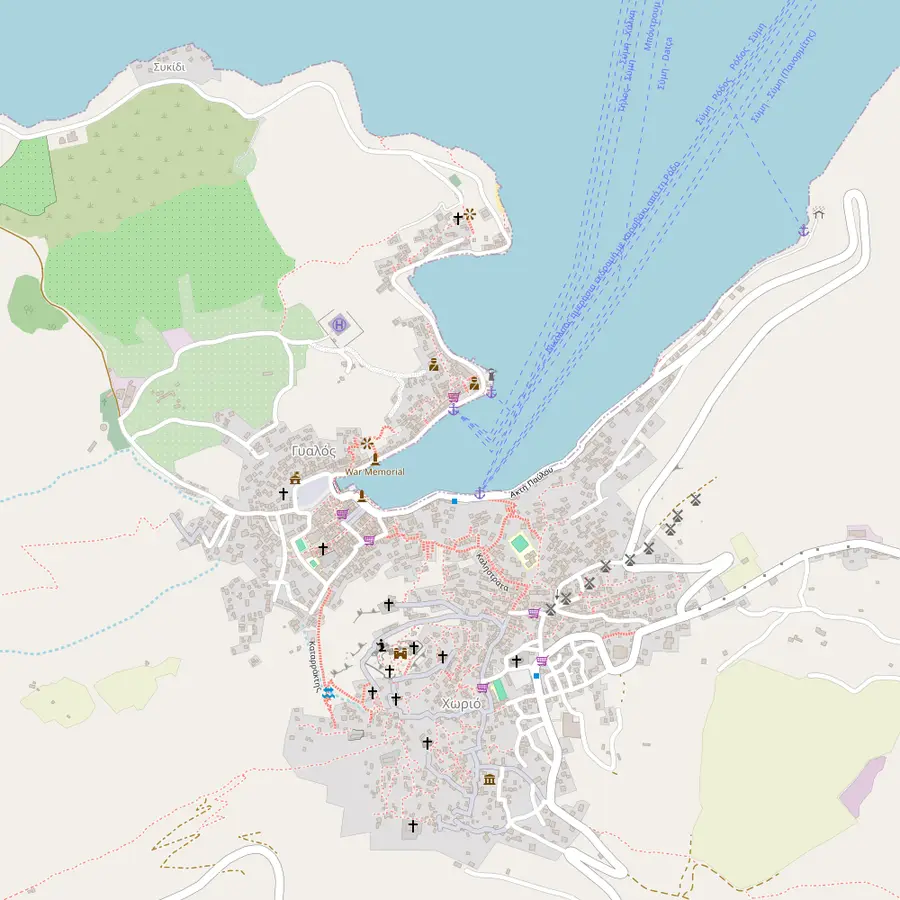 15Clock Tower16Kali Strata5Chorio17Castle6Nos
- 1Rhodes town (Mandraki and Kolona)
This site's boat leaves from Mandraki Harbor, and Sebeco Lines' speedboat from Kolona Harbor.
In Google Maps ↗ - 2Faliraki
Faliraki Sea Lines picks up from four stops on the beach, the first at 10:00.
In Google Maps ↗ - 3Kolymbia
A boarding option for this site's tour and the start of a Kolymbia boat to the island.
In Google Maps ↗ - 4Gialos
The harbor of Symi, where SP Cruises' boat ties up; the merchants and captains of the island once lived here.13
In Google Maps ↗ - 5Chorio
The oldest part of town, gathered around the castle and joined to the harbor by 500 stone steps.3
In Google Maps ↗ - 6Nos
An organized beach next to Gialos, with umbrellas and sun beds.22
In Google Maps ↗ - 7Emporios
The second harbor of the island, with a few houses and a beach with a taverna.16
In Google Maps ↗ - 8Pedi
A seaside village 2 km from Chora; taxi boats leave from here for other beaches.1523
In Google Maps ↗ - 9Agios Nikolaos
A sandy beach with shallow, clear water and a taverna.24
In Google Maps ↗ - 10Agia Marina
A small sandy beach facing a rocky islet with a church.25
In Google Maps ↗ - 11St George's Bay
Agios Georgios Dysalonas: a beach below a sheer cliff on the east coast, reached only from the sea.26
In Google Maps ↗ - 12Nanou
A pebble bay with a taverna, reached only from the sea.18
In Google Maps ↗ - 13Marathounda
One of the few beaches on the island that you can drive to.27
In Google Maps ↗ - 14Panormitis Monastery
The most important religious monument of the island, on the south-west side among cypress and pine.45
In Google Maps ↗ - 15Clock Tower
The stone clock of 1881 on the waterfront, the first sight on arrival.11
In Google Maps ↗ - 16Kali Strata
A set of 500 wide steps between the harbor and Chorio.28
In Google Maps ↗ - 17Castle
Built in the 14th century by the Knights of St. John on the ruins of a Byzantine castle.8
In Google Maps ↗
Checklist
Before you sail across
01
For the day
- Sun cream, a hat and water for the harbor
- Swimsuit and towel for the bay
- Shoes that grip on worn stone steps
02
For the plan
- Know your boat's time back in Gialos
- Your booking confirmation
- Free cancellation up to 24 hours ahead
Video
The full guide to Symi - All you need to know
The clip stays off YouTube's servers until you press play.
The monastery in the south
The other great name on the island sits far from the harbor. The Monastery of the Archangel Michael at Panormitis stands on the south-west side of the island among cypress and pine, and the municipality calls it the most important religious monument of Symi.45 It is the largest of nine Archangel monasteries on the island.4
Its present form dates from 1783, when the Symi monks Neophytos and Kallistos rebuilt the church that pirate raids had destroyed.9 The tall bell tower that you see from the sea was begun in 1905 and finished in 1911.29 Pilgrims come from far away, and the municipality counts it, with Patmos, as one of the two largest pilgrimage sites of the Dodecanese.30
Panormitis is a separate trip from the harbor. You can reach it from Gialos by caique or by road.5 Some day trips from Rhodes stop there first: one ferry day spends 1 hour at the monastery and 3.5 hours in the harbor town. The boat this site books goes straight to Gialos and St George's Bay instead.
Beaches and bays around the coast
The coast is mostly rock, broken by small bays. Several of the best known can only be reached by water: Agios Georgios Dysalonas, Nanou and Maroni are all listed as reachable only from the sea or by boat.171831 From Pedi, a village close to Chora, taxi boats run to other beaches, and some you can walk to.1523
Closer to town there are easier options. Nos lies next to Gialos and is easy to reach, with umbrellas and sun beds.22 Agios Nikolaos has sand, shallow clear water and a taverna, and Marathounda is one of the few beaches you can drive to.2427 On a day trip there is rarely time for these, which is why the swim stop on the boat matters.
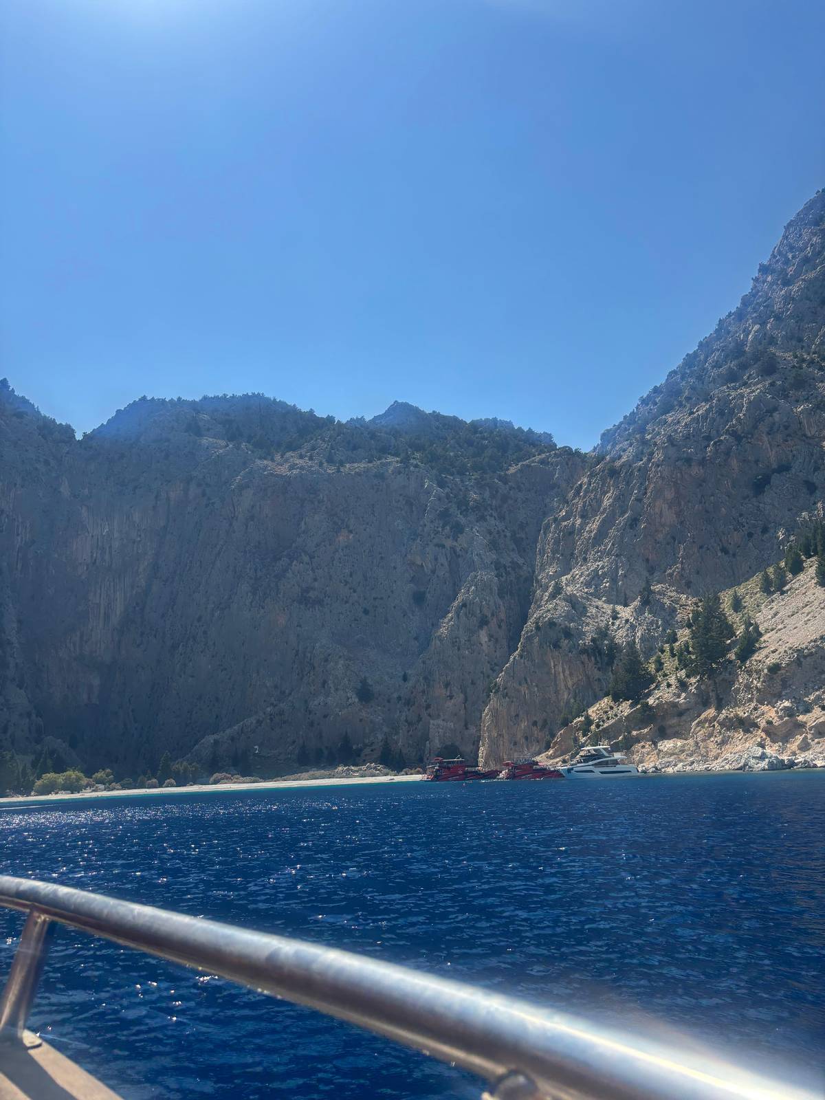
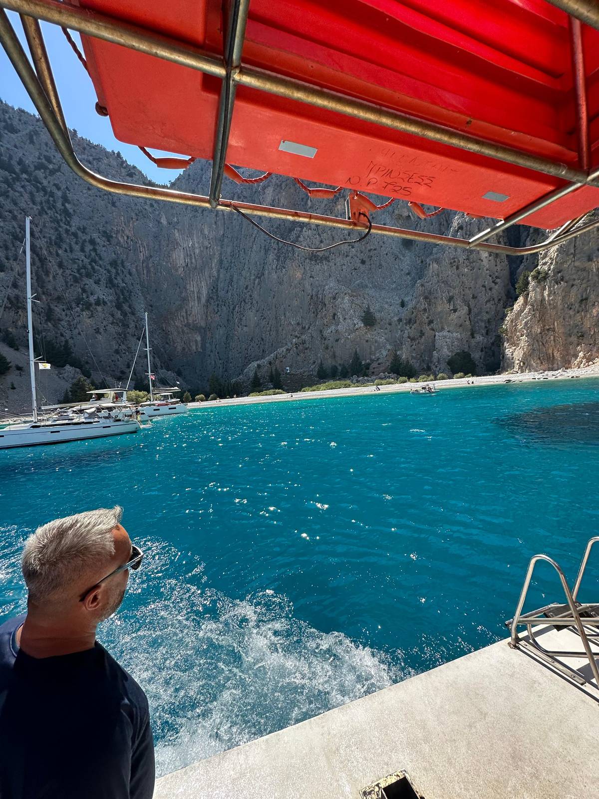
The most famous bay is St George's. The municipality calls Agios Georgios Dysalonas the largest and most impressive beach of the island, below a vertical cliff on the east coast, reachable only from the sea.26 This site's boat stops there for 30 minutes of swimming on the way back from the harbor.
How a day trip from Rhodes fits the island in
For most travelers Symi is a day out from Rhodes rather than a stay. The trip this site books runs a high-speed boat from Mandraki Harbor, with a cruise of 1 hour to Symi, 3 hours of free time there and a swim stop at Saint George Bay before the run home. It is rated 4.72 from 3,658 reviews and starts from $69.
Three hours is enough for the harbor, a climb part of the way up the steps and a long lunch by the water, but not for the monastery or the far beaches, which sit at the other end of a winding road or a boat ride away. Think of the day as a first look rather than the whole island. If those matter to you, a ferry day with Panormitis or a night on the island is the better plan. The Greek National Tourism Organisation puts the ferry from Rhodes to Symi at 1 hour and 30 minutes.32
The booking terms are easy to live with. Canceling stays free until 24 hours in advance, and the seat can be reserved now and paid for later. Departures leave at 9:00, 11:00 and 15:15, and the captain may change the route or the swim stop if the weather requires it.
Book your seat
Symi's harbor and the bay are waiting.
Pick a departure, swim at St George's Bay and cancel free up to 24 hours before.


You ask,we answer.
Is Symi worth visiting on a day trip?
Yes, for the harbor. Three hours show you Gialos and the steps; the monastery and far beaches need more time.
How big is the town?
Harbor and village together. Chora joins the harbor of Gialos to the older village of Chorio on the hill.2
How many steps does the Kali Strata have?
500. Stone steps that once carried the island's trade between harbor and village.3
Why are the houses so grand?
Sponges and shipping. The island once had the largest sponge-fishing fleet in the whole world.19
Can I see Panormitis Monastery from Gialos?
No, it is in the south-west. Reach it by caique or by road from the harbor.5
How high is the island?
Its top reaches 560 meters. A forest of pine and native cypress lies behind the highest mountain.7
How long is the boat ride from Rhodes?
1 hour on this site's boat. The listing gives a cruise of 1 hour out; the way back runs via the swim stop, 20 minutes to the bay and 70 minutes on to Rhodes.
Sources
What this guide is based on
- 1Greek National Tourism Organisation (Visit Greece)Symi: a neoclassical gem in the heart of the Aegean Sea↩
- 2Dodekanisos SeawaysSymi - The island of Nireus↩
- 3Municipality of SymiΟικισμοί - Χωριά της Σύμης (Settlements)↩
- 4Municipality of SymiΑρχάγγελος Μιχαήλ, ο Πανορμίτης της Σύμης↩
- 5Municipality of SymiΑρχάγγελος Μιχαήλ, ο Πανορμίτης της Σύμης↩
- 6Greek National Tourism Organisation (Visit Greece)Symi: a neoclassical gem in the heart of the Aegean Sea↩
- 7Greek National Tourism Organisation (Visit Greece)Symi: a neoclassical gem in the heart of the Aegean Sea↩
- 8Dodekanisos SeawaysSymi - The island of Nireus↩
- 9Holy Metropolis of SymiΙερά Μονή Πανορμίτου (Holy Monastery of Panormitis)↩
- 10Municipality of SymiΗ ιστορία στην Σπογγαλιεία (Sponge diving history)↩
- 11Municipality of SymiΑξιοθέατα (Sights)↩
- 12Municipality of SymiΑρχιτεκτονική (Architecture)↩
- 13Municipality of SymiΟικισμοί - Χωριά της Σύμης (Settlements)↩
- 14Municipality of SymiΟικισμοί - Χωριά της Σύμης (Settlements)↩
- 15Municipality of SymiΟικισμοί - Χωριά της Σύμης (Settlements)↩
- 16Dodekanisos SeawaysSymi - The island of Nireus↩
- 17Dodekanisos SeawaysSymi - The island of Nireus↩
- 18Municipality of SymiΠαραλίες (Beaches)↩
- 19Municipality of SymiΗ ιστορία στην Σπογγαλιεία (Sponge diving history)↩
- 20Municipality of SymiΗ ιστορία στην Σπογγαλιεία (Sponge diving history)↩
- 21Municipality of SymiΑξιοθέατα (Sights)↩
- 22Dodekanisos SeawaysSymi - The island of Nireus↩
- 23Municipality of SymiΠαραλίες (Beaches)↩
- 24Municipality of SymiΠαραλίες (Beaches)↩
- 25Dodekanisos SeawaysSymi - The island of Nireus↩
- 26Municipality of SymiΠαραλίες (Beaches)↩
- 27Municipality of SymiΠαραλίες (Beaches)↩
- 28Municipality of SymiΑξιοθέατα (Sights)↩
- 29Holy Metropolis of SymiΙερά Μονή Πανορμίτου (Holy Monastery of Panormitis)↩
- 30Municipality of SymiΑρχάγγελος Μιχαήλ, ο Πανορμίτης της Σύμης↩
- 31Dodekanisos SeawaysSymi - The island of Nireus↩
- 32Greek National Tourism Organisation (Visit Greece)Symi: a neoclassical gem in the heart of the Aegean Sea↩
Keep reading